Basic information
| Stránky: | Moodle ZČU |
| Kurz: | CBG/FGCRZ - Fyzická geografie ČR |
| Kniha: | Basic information |
| Vytiskl(a): | Nepřihlášený host |
| Datum: | pondělí, 9. listopadu 2026, 05.35 |
1. What is the Czech Republic
The Czech Republic (Czechia, CR) is a independent state in Central Europe. The Czech Republic is a pluralist multi-party parliamentary representative democracy, with the President as head of state and Prime Minister as head of government. The Parliament is bicameral, with the Chamber of Deputies (200 members) and the Senate (81 members).
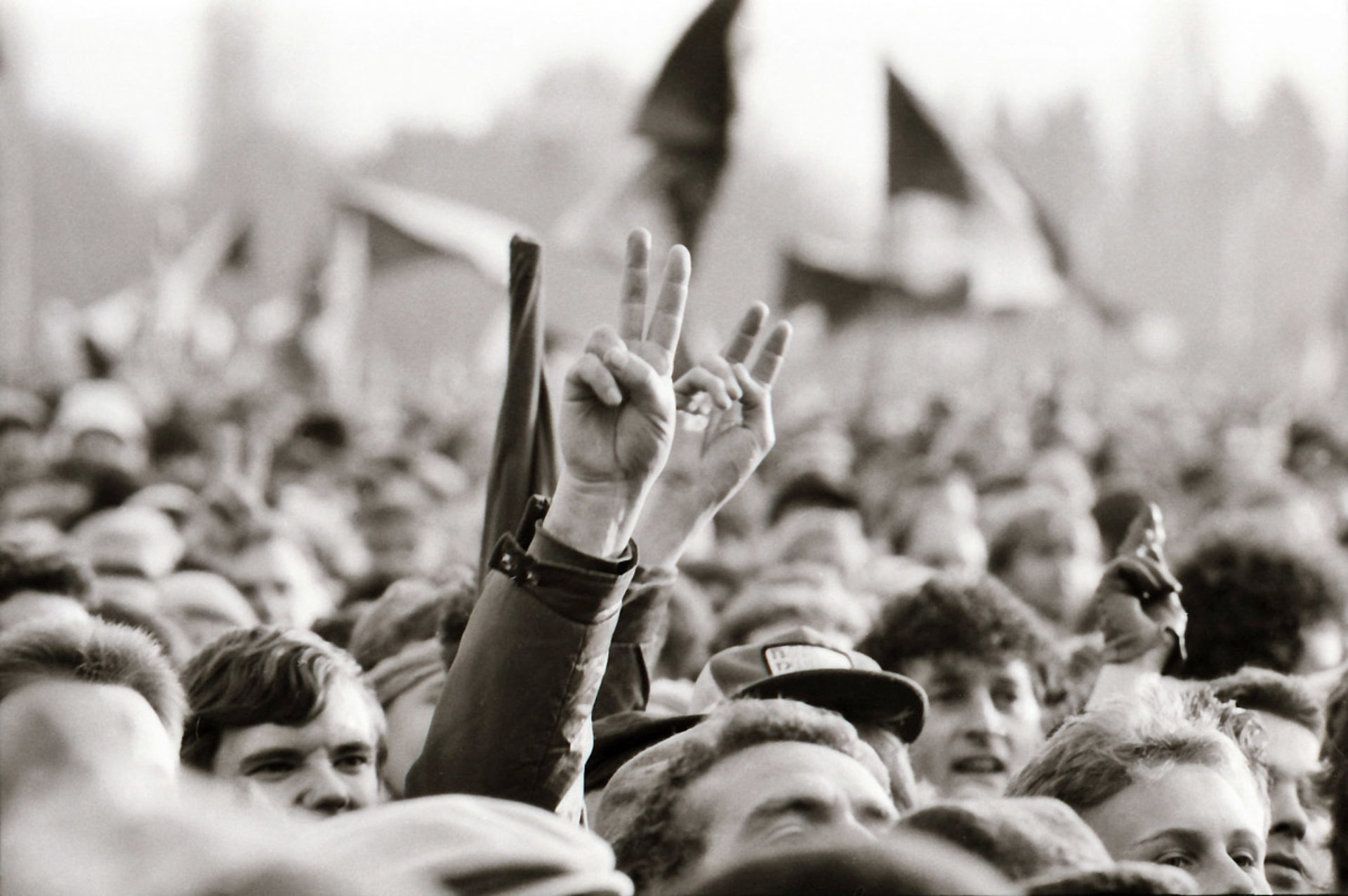 Current state exists from 1st of January 1993 when was former Czechoslovakia dissolved and its constituent states becoming the independent states of the Czech Republic and Slovakia. The modern Czech history (20th century) is assocciated with both, communism and constitutional monarchy.
The history of Czech nation and Czech Republic is much longer.
Here you can read a brief history of the Czech Republic.
Fig. 1. Wenceslav's Square in Prague during the Velvet Revolution in 1989 (Source: https://vysehradskej.cz/sametova-revoluce/).
2. Where is the Czech Republic
2.1. Geographical location
Czechia is located in the Central Europe. Its geographical midpoint has the coordinates 49° 44' 37.5″ N, 15° 20' 19.1″ E. Simply put, the 50th parallel and 15th meridian run through the territory of Czechia.
The Czech Republic has an area of 78,866 square kilometers and has 278 km in width and 493 km in length.
2.2. Political/administrative location
The traditional delimitation of the territory is a political delimitation using the state borders. The course of the Czech state borders is mostly historically substantiated. In fact, the modern Czech state borders are stable from 1918 (independent republic of Czechoslovakia) but there are some historical milestones which changed the course of the borders.
1. First Czechoslovak Republic
The existence of the independent state (Czechoslovak Republic) started in 1918. There was delimitated a new borderline which was based on then existing state borders (borders of Bohemian Crown which used to be a part of Austro-Hungarian Empire), reflected nationality displacement (Slovakian-Hungarian borders were not historically substantiated) and the fact that new Czechoslovakia joined the winning Allied powers and then it could claim areas which were strategically important even if they were inhabited with people with non-Czech or Slovak origin (Germans, Polish, Hungarian and Ruthenian). This new country incorporated the Bohemian Crown (Bohemia, Moravia and Silesia) and parts of the Kingdom of Hungary (Slovakia and the Carpathian Ruthenia).
The 27 % of the population of former Austria-Hungary was now part of a new state.
2. Second World War
The period of the Second War War hit very hard the territorial integrity of the Czechoslovakia. Poland annexed the Zaolží area around town Český Těšín (nowadays splited between Czechia and Poland) in 1938. Hungary gained parts of Slovakia and the Subcarpathian Rus. The remainders of Slovakia seceded from
Czecho-Slovakia in 1939, and allyied with Hitler's Germany.
The border regions of Bohemia, Silesia and Moravia with the German nation majority - so called Sudetenland was attached to the Third Reich. The remaining Czech territory was occupied by Germany and transformed into the so-called Protectorate of Bohemia and Moravia.
After the Second World War the borders were returned to the prewar extent.
3. Czech-Slovak"divorce" in 1993
After the dozens of years without any extensive borderline changes and after the Velvet Revolution (change of the political regime) a new territorial change came in 1993. On 1 January 1993, the Czechoslovak Federal Republic (from 1989 successor state of socialistic Czechoslovakia) peacefully split into two independent countries of the Czech Republic and Slovakia. New borderlines between both countries were set.
2.3. Geological and geomorphological location
Czech territory is part of two orogeny systems - Variscan and Alpine. From the geological point of view, the Czech Republic is very diverse area covering two geological units - the Bohemian Massif and the Western Carpathians. These units have different age, different tectonic history and different rock composition. The development of the Bohemian Massif involves long period from the Palaeoproterozoic to the recent period. Geological history of this part of the Czech Republic is connected to the Hercynian Western Europe (e.g. Germany or France). The second part - the West Carpathians - is much younger (the Mesozoic to the Cenozoic) and is connected to the other part of teh Alpine orogeny in the southern and Eastern Europe (e.g. the Alps, Pyrenees and Carpathians).
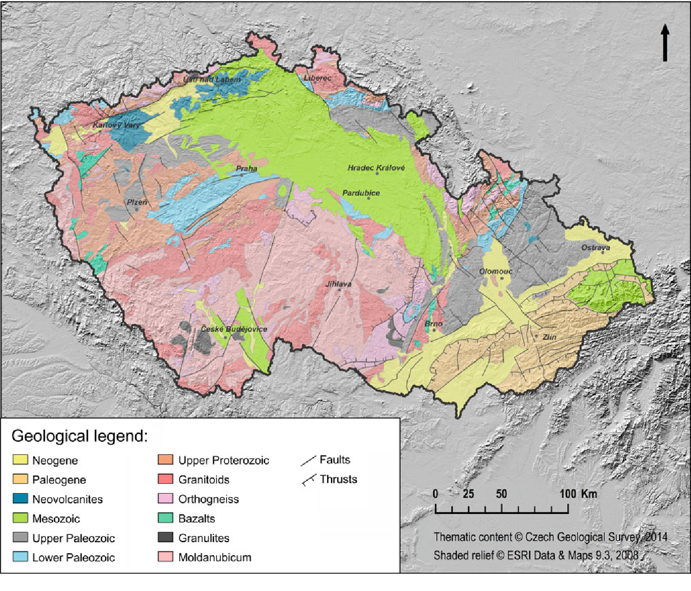
Fig. 1. Simplified geological map of the Czech Republic.
The CR has the landscape full of diverse landforms which are the result of the intersection of Eurasian geotectonic and bioclimatic domains. There is a tundra-like landscape and periglacial and glacial features in Sudetic Mountains, picturesque sandstone landscape in Eastern and Central Bohemia, vineyard-limestone landscape in South Moravia, volcanic relief in Northern and Western Bohemia and many more.
2.4. Climate
The CR is located in the temperate climate zone with four seasons, in a transitional zone between continental and maritime climate regime. The influence of latitude is insignificante but the climate variability is strongly dependent on the altitude. The mountain areas are colder and more humid than the lowland areas. The westerlies are dominant.
2.5. Hydrogeography
The area of the CR is divided in three major drainage basins - the North Sea, the Baltic Sea and the Black Sea. Vast majority of rivers in the CR springs here and flows out of the state borders. The CR is the source area for waters of major European rivers - Labe (Elbe), Odra (Oder) nad Dunaj/Danube (does not flows through the area of CR).
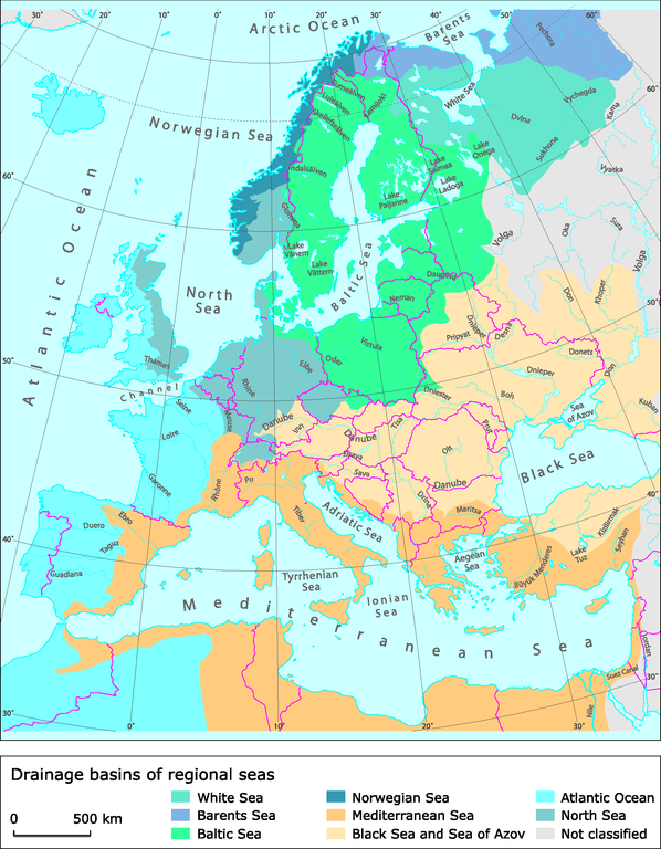
Fig. 1. Drainage basins of regional seas (Source: European Environment Agency (EEA) - https://www.eea.europa.eu/data-and-maps/figures/drainage-basins-of-regional-seas-1; Data owner: Eurostat).
2.6. Pedogeography
Majority of Czech area is covered by soil types which are zonal - specific for the climate zone. Predominant soil type is cambisol which covers almost 45 % of arable land, following by luvisols and chernozems. Cambisols are common in Europe and can be veryproductive agriculturally. Chernozems show high biological activity and are typically found inthe long-grass steppe regions of Europe, especially in Eastern Europe, Ukraine, Russia.
2.7. Biogeography
The CR is situated in the zone of temperate broad-leaved deciduous forest, which in the south-east borders on the forest-steppe zone. Its current vegetation is affected by abiotic conditions such as geology, soil and climate, historical biogeographical processes and human activity. The CR is a part of the continental biogeographical region.