How does geology affect the land cover?
1. Loess and agriculture
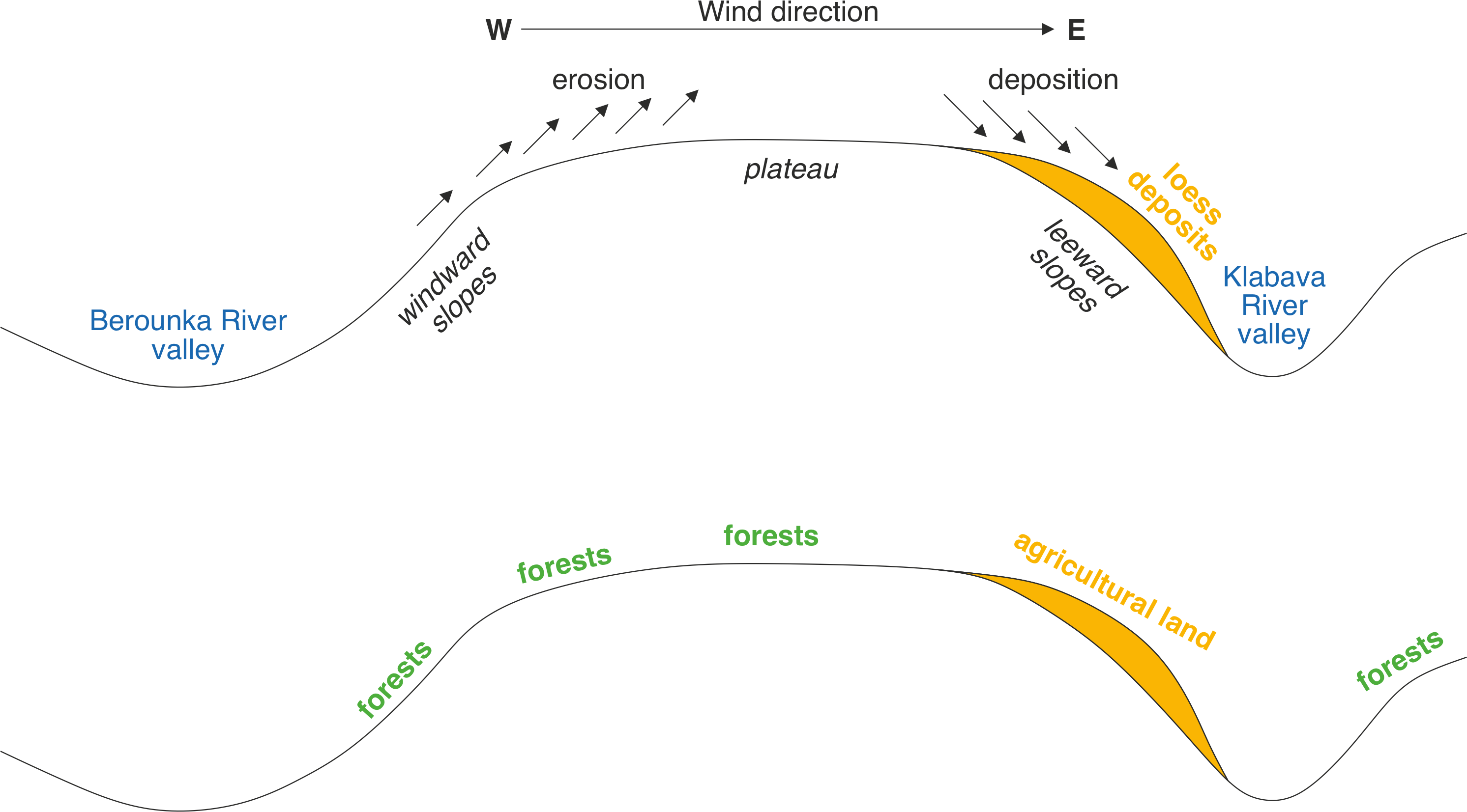
During Pleistocene, ice ages and interglacials alternated. During ice ages, vast portions of Europe were ice-covered. Glacial rivers transported large volumes of glacial ground silt (<0,063 mm) and clay (<0,002 mm) deposits sediments during icesheet and/or icecaps spring and summer melting. These rivers formed large floodplains with braided river environment. The flow of these rivers was greatly reduced during autumn and winter when melting of ice ceased and vast portions of non-vegetated and submerged floodplains were exposed to the wind. The winter (westerly) winds caused winnowing finer (silty and clayey) deposits from the coarser (gravelly) matrix. Strong winds transported this material on a long distances across the sparsely vegetated Europe and deposited this material downwind, especially on the leeward slopes, when the wind lost part of its energy.
These above-mentioned loess deposits are preserved on quite a few places around Pilsen. They are almost exclusively limited to the east leeward slopes. In the area where our excursion takes place, can be very well described differences in the land-use and land cover connected with loess deposition. West windward slopes and flat surfaces of plateaus are covered by soils with very limited fertility and are mainly used for foresting and thus are covered by semi-homogenous forest. On the other hand, on the east leeward slopes with loess cover much fertile soils evolved during the Holocene. These slopes are today used mainly for agriculture and are covered by arable land.