
Geology of the Czech Republic
1. Introduction
Small area of the Czech Republic has varied geology and tectonic development. The area of CR is subdivided in two geological units - the Bohemian Massif and the Western Carpathians, and its development involves a long time period from the Paleoproterozoic to the recent period, i.e. about 2.1 billion of years.
The Bohemian Massif is a significant and extensive fragment of the Variscan orogen formed during the Devonian and the Carboniferous (over the interval c. 380-320 Ma). The eastern part of Moravia and Silesia belong to the Western Carpathian orogen, which is one of sub-parts of the Alpine orogen—a vast mountain system of southern Europe. It was formed by collisions of continental fragments situated between the northern edge of Africa and the so-called Epi-Variscan Platform of Western Europe during the Mesozoic and the Tertiary.
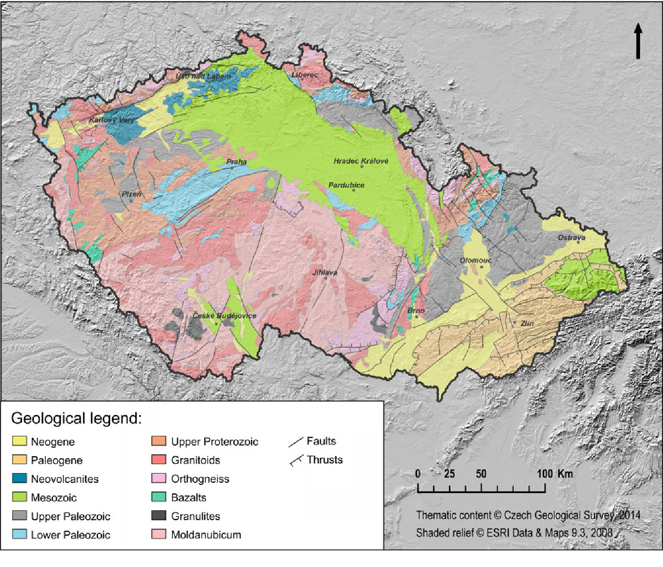
Fig. 1. Simplified geological map of CR (Source: Czech Geological Survey in Pánek a Hradecký Eds., 2016). The boundary between the Bohemian Massif and the Western Carpathians is the right edge of the Neogene rocks (yellow) in the eastern part of the CR.

Fig. 2. Extremly simplified geological map.
From the geological point of view it is important to realize that the territory of the CR:
- did not always have its current geographical location
- did not always have the temperate climate
- did not always have the current elevation and relief
- wasn't always a dry land
Further reading
Grygar, R. Geology and Tectonic Development of the Czech Republic. In Pánek, T. a Hradecký, J. (Eds.) Landscapes and Landforms of the Czech Republic. Switzerland: Springer International Publishing, 2016, p. 7-18.